
This week’s reading covered 20th century mapping techniques, particularly regarding increasing standardization of signifiers, increasing influence of technology (including classified government sources), and changing consumer demand for maps.
Although we were assigned only the fifth chapter of Kenneth Nebenzahl’s Lectures in the History of Cartography : Cartographies of Travel and Navigation, I reading a good portion of the whole book. His history of the creation of a “national motorized space” brings to mind many of the concepts we’ve discussed this semester, but it struck me that he didn’t explicitly address an important reason that consumers so eagerly consumed these road maps: fear for safety.
Our review of historical atlases caused several of us to reminisce fondly of past travels with family or friends. But I also remember a night on the side of road on US-17, a rural, two-lane highway through the swamps just north of Elizabeth City, NC. We had spent the day at the base exchange in Norfolk, and were headed back late that evening for our home in Elizabeth City. The car broke down and Dad limped it in to a wide spot on the shoulder. There we sat, in pitch black darkness, until finally another car came down the road and stopped. Two men got out of the car and offered to give Dad a ride to town to get a tow truck, while the other man stayed behind. I remember Mom’s anxiety, for Dad’s safety and for our own. She made us lock the doors and our “protector” seated himself nearby for the wait. And then……nothing bad happened. Dad showed up with a tow truck and the two men resumed their journey.
Nothing horrible ever did happen to us, but it could have (and did to others.) That was the point of collecting those free oil company road maps and Triptiks: it gave us important reference points to fuel, hotels, food, and emergency medical care. To the extent that they reduced “adventure,” they advanced our safety.
Many years later, I took my daughter on her first long-distance road trip after getting her license. We had GPS device by then, but we took an atlas. I taught her the essentials of freeway navigation: how to interpret the mile markers, the highway and road numbering system, the hospital signs, and billboards advertising food, fuel, and lodging. I wanted her to be able to navigate independently if the cell phone and GPS failed.
Although the book was only published five years ago, Nebenzahl’s concluding chapter on automated navigation is already quaint. I use a cellphone app called Waze (recently acquired by Google) for virtually all travel beyond my local town. Besides routing), it gives users crowd-sourced warning of road hazards and traffic jams ahead and will give me alternatives to get around traffic delays. I can query for gas stations and see current prices, search for restaurants, and send ETA notifications to other users, who can also view my location on the route.
Notably, I recently was just behind a major car accident on a highway. Pulling to the side of the road, I could see that other people were already calling 911. I tapped in “major accident” into Waze and exited the car to provide assistance to a seriously injured driver. When I returned to my car afterwards, there was a large red banner on the app: “Your report has been received and EMS notified. Help is on the way.” Not only had Waze warned other drivers behind me (and re-routed many of them), it had notified emergency dispatchers of the accident and the location based upon my cell phone position. Unlike other drivers calling 911 who had to make the best use of their personal knowledge of their spatial location, Waze was able to transmit an exact, accurate position.
Waze, like any app that requires a cell phone position, raises privacy concerns. Users should be cautious and ensure that they exercise their options (including not to use it) carefully. The old trade-off was a gentle nudge towards using highlighted route or the sponsoring company’s fuel station or hotel. The new trade-off is privacy and use of movement data for unanticipated reasons (location-based advertising, law enforcement surveillance, stalking.) These are the cartographic absences of web-connected maps.
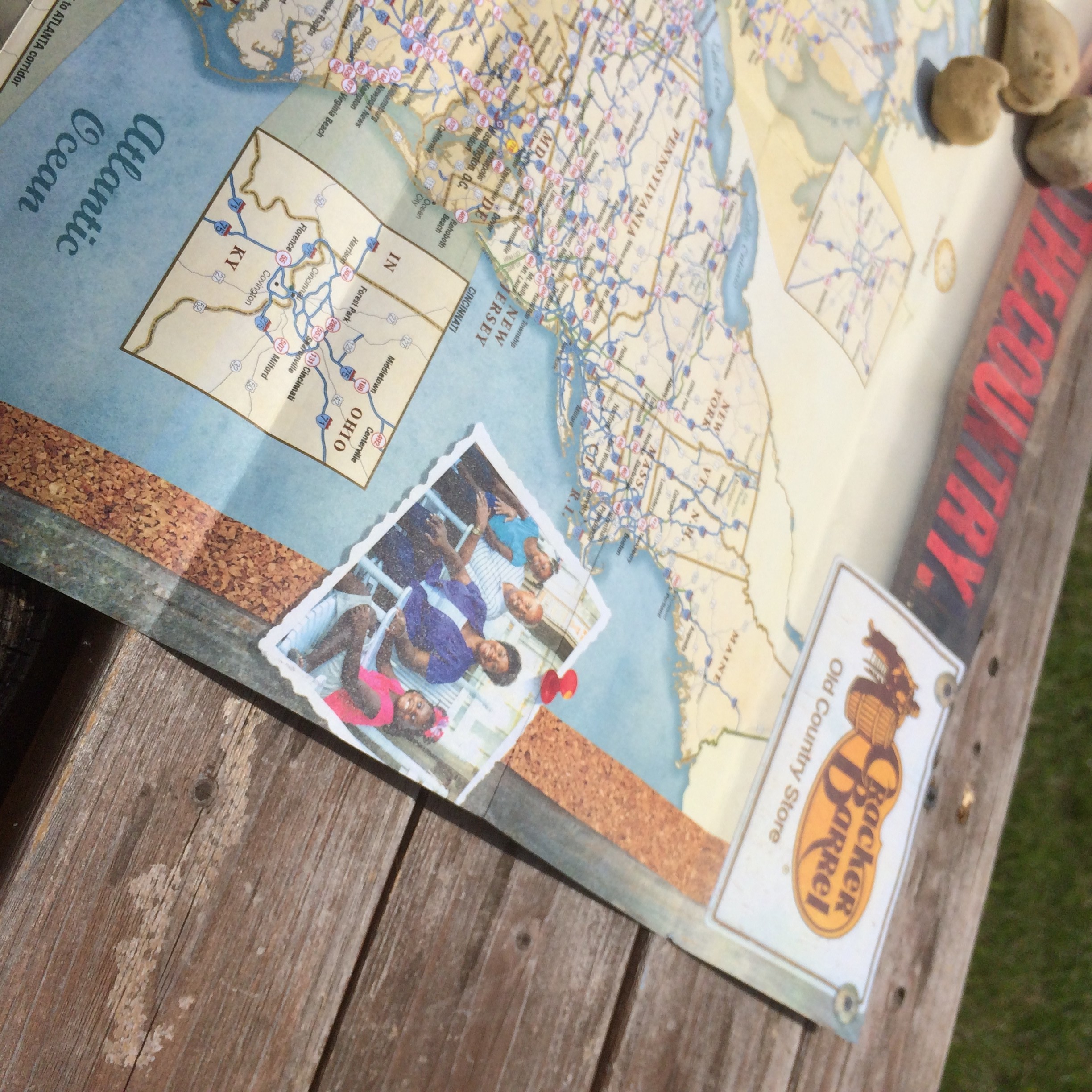
Meanwhile, there is still one paper map that we carry on our travels: Cracker Barrel’s US road atlas, with every franchise location highlighted. Like the old oil company maps, they’re intended to encourage us to stop at their restaurants along the way. The artwork depicts a happy family sitting on the distinctive front porch, further inviting us to stay and enjoy ourselves and maybe buy a few things in the gift shop. But we are not hapless victims of their corporate machinations; we use the map as a way to reduce uncertainty about the availability of food that meets our dietary, budget, and efficiency requirements as we happily motor down the road toward the adventures we choose. (We have maps for those, too.)

You make a very good point about the importance of knowing how to read road maps in this age of GPS. I always chuckle at my mom, who always relies on paper maps even though she has a GPS device, but they are actually really valuable to have on hand. Sometimes GPS signals or cell phone connections fail in remote areas, which has happened to me many times in the rural Pennsylvania mountains, and I was glad I had a road map stashed in my car at the time. I had no idea that Waze had been acquired by Google, nor that it could send accident reports to EMS. What a great feature!
Your latest post is very nicely written. I taught all three of my kids how to read a paper map. Two of them still prefer the method over GPS as do I. While on a cross-country drive to Montana this spring, I stopped at a rest area and spread a large map of the western states over my hood. I got more than on comment on how that is now a rare sight.