
Found it!
Initial research indicated that Malcom and William had farmed hogs and some cotton in Alabama; Malcom was also a cabinetmaker. My first clue about where they lived came from the recollections of Minnie McLane Carter (a great-granddaughter of Malcom), who stated that when the family moved to Henderson County, they “…first lived for a few years on one of the Miller farms near Fincastle. They later lived for several years on the Bush Woffard plantation, a few miles south of Fincastle. Their last move was south of Poynor on what is now called the Fisher place.” Another descendant states that Malcom and his son, William, were cotton farmers and owned one of the first local cotton gins in Fincastle. (See Frankston and Its Neighbors)
The 1890 tax roll for the county lists the following information about McLane family members:
- — W. T. McLane was taxed on 130 acres on the Z. W. Panner survey and 120 acres on the J. J. Martinez survey.
- — T. A. Phillips (married to William’s sister, Nancy) was taxed on 146 acres on the J. J. Martinez survey.
- — James Monroe Dansby (married to McLane’s daughter, Hannie) is assessed as having no real property to be taxed.
I caught a lucky break and found a 1951 school district map of the county at the Historical Commission offices in Athens. It depicts the various surveys in the county:
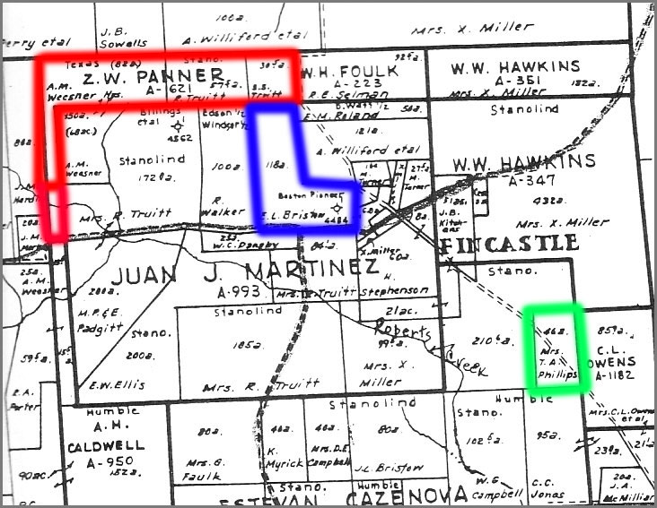
The Z. W. Panner survey is outlined in red. A line divides the dogleg, but no separate survey or property owner is listed. I believe the lower part of the property is either a part of the original Panner survey or at least includes an easement to permit access to the main road. A second property is outlined in blue; as of 1951 the owner’s name is listed as E. Bristow. McLane’s daughter Ella married a Bristow and I believe that this may be the property listed in 1890 as McLane’s portion of the J. J. Martinez survey. Lastly, I have outlined in green the property listed as belonging to T. A. Phillips — I do not have enough information to determine whether this is part of the original Martinez survey, or a subsequent land purchase.
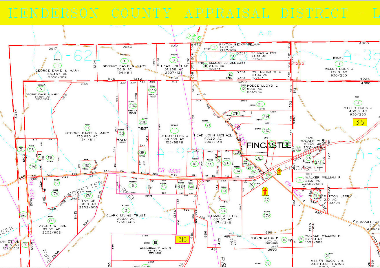
This is a modern plat map. The names of landowners are different, but the outlines of the original surveys are still discernible, especially the distinctive Z. W. Panner boundaries.
I created a transparent overlay from this plat map and superimposed it over Google Earth; you’ll want to open it up full size to get a better view.
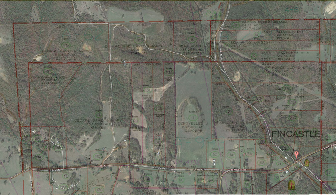
Using landmarks, I inserted markers at the corner of the Z.W. Panner survey. A land calculator measures this out at approximately 130 acres total — this, then, is part of the land that William and his father farmed.
You can explore Fincastle and the McLane farmland at the Google map I created here:
